An Interview with Chad Harrison, Aggregates and Environment Manager, E Construction
E Construction Ltd., a subsidiary of Colas Canada, part of the worldwide Colas SA Group, is one of Western Canada’s largest paving contractors. E Construction has over 650 employees providing products and services throughout Saskatchewan, Alberta and the Northwest Territories. Chad Harrison is the Aggregates and Environment Manager at E Construction, responsible for all of the company’s aggregates resources including reporting inventory at more than 40 sites.
We talked with Chad about his work and how he uses Kespry.
Chad: I coordinate all the inventory measurements at year end, and our intermittent checks throughout the year. We use Kespry to confirm quantities after crushing, for all of our operations. We also use it to do checks when we’ve done hauls without scales. For example, when we haul reclaimed asphalt pavement into a stockpile site, we will use Kespry to confirm the quantities on that material.
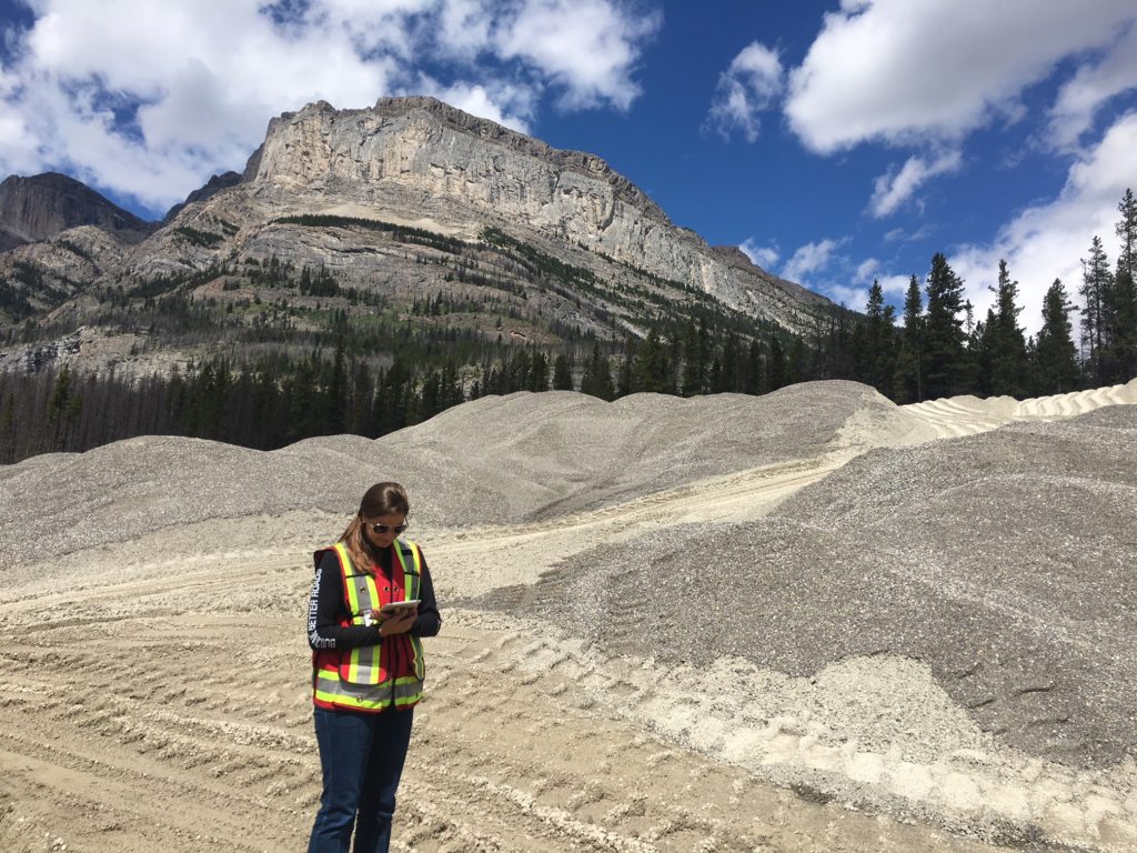
Jodi Ehrman, Aggregates and Environment Coordinator, plans a mission on her Kespry system.
Why did you start using drone technology?
Chad: We were trying to get away from RTK. I was pushing to get away from old technology and get into something new because inventory was just too variable, and it was too much work at the end of the year with the short time we had to get the job done. There’s some cost to embracing new technology, but it makes sense. If you don’t do it, you’re going to get left behind.
Why did you choose Kespry?
Chad: I really liked the accuracy of the Kespry System and that Kespry is a subscription service, so we get updated technology. The technology’s changing so fast. We used to spend a lot on a less-accurate RTK GPS head that’s only good for four years and then we would have to re-buy the whole thing – not to mention the time required to train and get people up to speed on how to use it properly and accurately. It’s cut down on my frustration during our year-end inventory process.
What is the impact for accounting?
Chad: On the accounting side, it’s definitely simplified things. Before Kespry, we were using RTK for survey. We did a drawing but we couldn’t spatially figure out things. It was basically just polygons on a sheet. Then we had to do a site sketch on top of that and then pictures of every pile. There was a huge amount of paperwork and office time to get it done. Whereas with Kespry, we send people out to fly the drone and it’s really rare that they miss anything. It allows us to have a nice, two-page report, where you can see everything. Having the data on the cloud, it’s easy to pull it up and see in 3D where things are. It has definitely simplified our year-end inventory process and it’s essentially third party. Kespry is a super handy tool. It’s nice because it picks up everything. Things don’t get missed. We do interim checks at a couple of our sites and sometimes we catch errors where people have been hauling out of the wrong pile. It’s important to track if we are taking material from the wrong product, because they have different prices.
How has Kespry improved your inventory process?
Chad: It’s basically how I justified getting the system. Colas is a public company, so we need to report year-end inventory. We used to have to have two to three crews running around with survey gear to get inventory all done in the timeframe we needed. Typically, we would need to stop operations and then do our inventory after, due to safety. Kespry allowed us to do inventory when they’re still doing production because we can snapshot it from above. It’s safe to do. We’re not having people walking on piles anymore. We don’t have to shut down operations to allow us to take inventory. If I had to guess on a cost savings, it’s probably $25,000 or $30,000 twice a year to do inventory. It’s pretty hard to compare Kespry to standard archaic GPS. To just be able to fly a drone for half an hour to pick up a quarter section, planned 160 acres. To do that in the past, it would’ve taken us 10 to 14 days, and they probably wouldn’t have gotten everything.
You mentioned the fact that Kespry is essentially third-party, audit safe. What does that mean to you?
Chad: There’s less confusion. There’s less questioning of the methodology. Our variance on RTK surveying was sometimes 10% depending on who we sent out. With Kespry, it really doesn’t matter who goes out and does it because we’re going to get the same answer. The repeatability has been a lot better for us. Even with our subcontractors, most of them have switched over to believing the drone data more than they do their belt scales.
How has Kespry changed the way that you work?
Chad: We work on large government contracts. The crushing companies’ subcontract responsibility is to make sure there is enough material in the stockpile for us to do the project. If we don’t have enough, we end up having to mobilize back end resource aggregate from elsewhere and possibly pay a high price for that. Kespry allows us to tighten up the amount we produce to have enough material for the project. This is definitely better.
How are you using Kespry for mine planning and site surveys in addition to inventory management?
Chad: We do large government projects sometimes out of our own pits, sometimes out of government operated pits. We would fly in all of those to give them a pit plan and a mining plan. Usually we’ll get a before shot and after shot and try to get an interim shot on the stripping we’ve done, over-burden we’ve removed. The detail is actually really impressive. You can see staining on the ground in the gravel pit if someone’s spilled diesel. That’s pretty handy to be able to catch as long as the conditions are right.
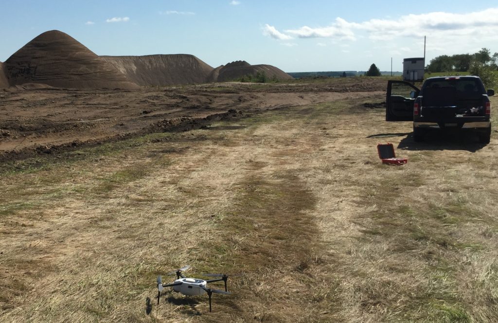
Kespry drone and Kbox ready for a mission at E Construction.
How has Kespry made work safer for your team?
Chad: It’s just inherently more safe. We want to get away from climbing piles. We used to have people climbing them in the middle of winter. They’d have to wear clamp-ons because they’re so slippery. It’s a lot easier to do inventory now. They don’t have to walk and climb the piles. Everyone really enjoys that.
Your team recently upgraded your system to a Kespry 2S. What kinds of projects are you planning with the 2S?
Chad: We like to pay subs for earth work based on either volume of material removed or placed, not truck box counts or guesses. That’ll be what lets us tighten up our numbers. We’ll also use it to be able to integrate properly with some of the design information and figuring out where to place dirt. Mostly it will be for tracking the quantities on work and measuring changes in piles.
E Construction works on big projects for the Department of Transportation. How are you using Kespry on construction projects?
Chad: We’ve flown a couple of projects to get some pictures of the project and before and after. We’ve used it at the Department for aggregate resources. They usually have piles of materials available for the project left over from past projects. Kespry lets you measure that quick and easy. Sometimes there are old stockpiles that need to be moved around. They don’t typically give you volumes on them. So instead of guys going out and just eyeballing, “I think that’s 5,000 cubic meters,” you can go out and measure it with the drone. Our capacity to do Earthwork is at a certain level before we need to subcontract it out. A big factor of us getting a recent job was knowing that the Earthwork number was within our capacity. We did that using the drone.
What do you love about your job?
Chad: I like my mix of office and outdoor work and the teamwork that’s involved in all the projects. None of the work that we do could get done without everyone having to work together, right from the start to finish. From estimating to production and quality control. Kespry Cloud has helped in reducing travel time for collaboration, too. Since we have images of the sites, we can just set up a Skype meeting, share a screen and talk about operating in a gravel pit because we have a snapshot. It’s a lot easier than trying to do a sketch and mark it up and send it by email and then try and explain things. Now you can just throw on the 3D view and say, “Take this. Move this here. Check over here. What’s wrong with this area?”

