
Data is becoming a precious resource that all businesses are collecting, but not every business has the capabilities or right tools to take advantage of. The ability to process and analyze incoming data that extend existing business lines and create resulting actionable insights is a top priority for industries around the world. So, it’s natural that these industries want to find new ways to take advantage of existing data on hand and further their understandings to be as efficient and profitable as possible, which is where Aerial Intelligence comes into play.
Aerial Intelligence technology provides a unique, new way for industrial businesses to automate manual processes to deliver better, faster, and more accurate data sets all while optimizing for safety and efficiency. Automation, Artificial Intelligence (AI), and data analytics are the core elements in what makes up Aerial Intelligence and enables business to change how they collect and find true value in that data. This underutilized tool has opened the door for industries like mining and aggregates, roofing, insurance, pulp and paper and more to automate their infrastructures and scale their businesses.
Drones are a pivotal aspect to the success of Aerial Intelligence because the technology allows for field workers to easily and autonomously design flight paths which leads to real-time insights and easy integration into any organization’s cloud-based workflow. Drones are being widely used for their efficiency in harvesting valuable industrial data. In the past, what took five workers and hours of labor to survey an area can now take one person and thirty minutes. Many drones are now touchless solutions with no joysticks, SD cards or complicated applications to mess with, creating a seamless process that takes you from drone to data much quicker than traditional methods.
While drones are a major factor to the success of an Aerial Intelligence program, other important methods of data extraction include sources like fixed cameras. Here, we’ll detail the top features and benefits of Aerial Intelligence programs and how it can make an impact on your business.
Features of Aerial Intelligence
- Aerial Mapping: With the use of drones, businesses can capture high-definition aerial imagery to create 2D and 3D models as well as detailed maps. The benefits of aerial mapping can include quick and accurate data collection along with improved safety of field workers in areas that are dangerous to access.
- Thermal Imaging: Trying to easily uncover heating and cooling issues or if you are worried about safety and trying to capture a large area in one sweep, aerial intelligence provides thermal imaging features to make your job easier and cost efficient. With the combination of drone and thermal technology, you can conduct your services in record time while using a fraction of the price.
- Inspections and Audits: Safety, cost-efficiency, accuracy, and speed are at the center of all aerial intelligence features. Traditional methods of inspections and audits are tedious and sometimes dangerous. Aerial intelligence technology can capture detailed data you can store and analysis without the long and arduous task of manual audits and inspections.
- Analytics and Reports: You have captured all this amazing data through Aerial Intelligence, but what is the next step? There are software and platforms available to digest, process and share this data at speed to create actionable insights for your business.
As mentioned, Aerial Intelligence is impacting industries around the world including insurance, mining and aggregates, pulp and paper, and process industries. Below are some examples of how Aerial intelligence is being used across these pivotal areas to gain efficiencies, lower costs and heighten employee productivity and safety.
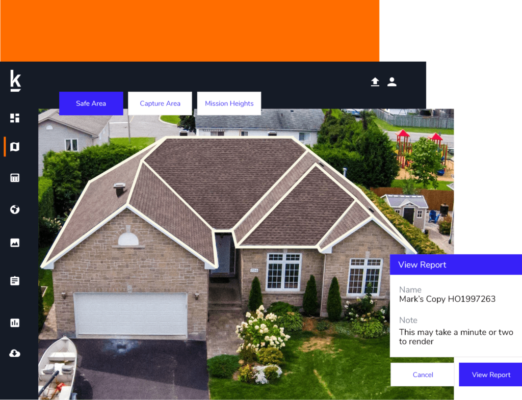
- Insurance
- Accurately determine distances, elevations, and volumes with a complete, high resolution model of a site or roof
- Reduce time and money, while increasing safety on roof inspections
- Decrease claim cycle times and increase up to three times as many claims daily
- Help inform underwriter decisions with high resolution images and data, such as test squares and dimensional analysis
- Produce comprehensive reports to share with clients
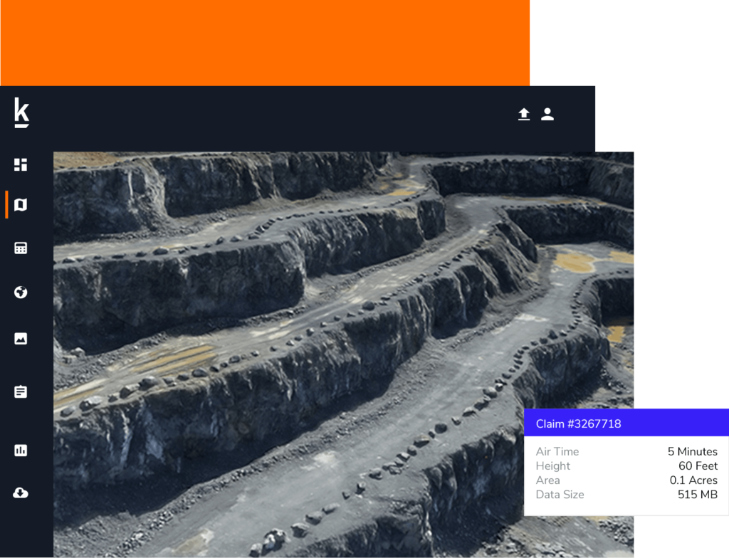
- Mining and Aggregates
- Simple and accurate inventory management and mine planning
- Intelligent mapping and surveying done with 500 acres of range in one survey session
- Produces data that is up to 80% more accurate than manual measurement
- Captures data in the toughest of industrial environments
- Pulp and Paper
- Increases accuracy of chip and roundwood inventories within 1-3%
- Removes third party involvement and streamlines process into one integrated drone solution
- Properly monitor incoming material with daily or weekly flight surveys
- Can be used to capture biomass cell changes in landfills
- Process Industries
- Push button take off and flight with self-guided landing
- Monitor conditions and quantities of storage tanks, buildings, pipelines, access roads and stockpiled materials with accuracy levels down to centimeters and millimeters
- Perform site inspections on tanks, stacks, structures
- Use artificial intelligence and machine learning to calculate accurate roof dimensions and coordinate maintenance
Many industrial businesses are realizing that Aerial Intelligence is not as complex as it once was. Leaps and bounds have been made in the field to create a flexible and comprehensive environment for users. The future of data collection for many industries looks like “smart inspections,” drone technology, automated workflows, and safer work environments. Aerial Intelligence is revolutionizing data collection for industry while improving employee safety – doing so faster and with more accuracy than previous methods. The future of Aerial intelligence is bright, and the limits of potential for businesses around the world is endless.
If you’d like to learn more about Kespry’s Aerial Intelligence platform, reach out at hello@kespry.com and someone will reach out to you. You can also do more research at the Kespry Resource Hub to see how Kespry works, what industries we help and more.