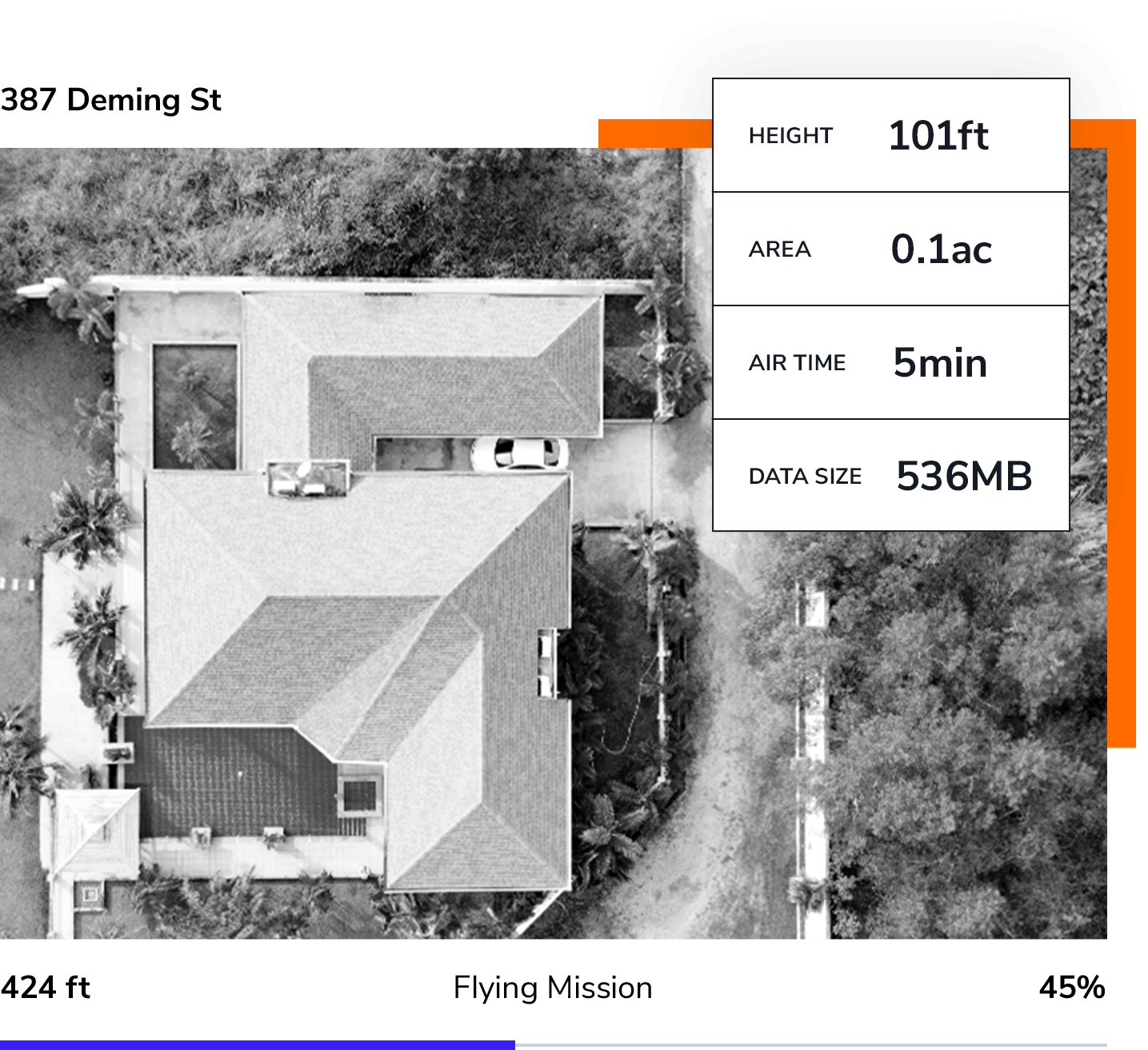
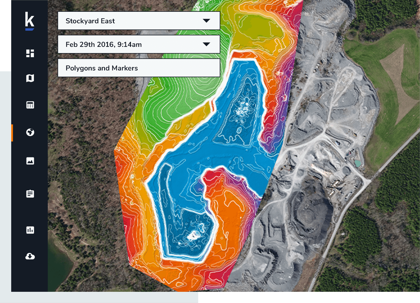
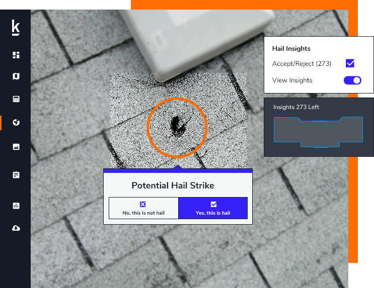
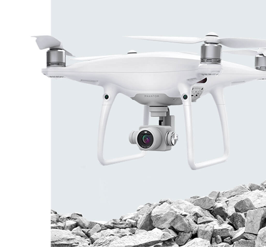
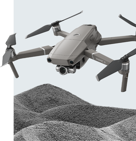
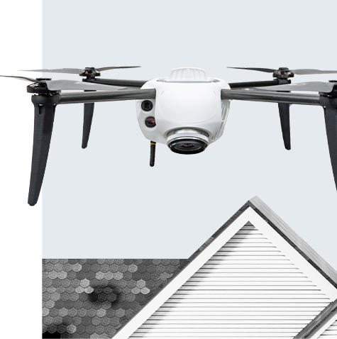
Step One: Plan and Fly

Plan and Fly

iPad Mission Planning and Autonomous Flight

Our iPad app walks you through a simple three-step process:

  1. Determine the area to survey or inspect
  2. Identify flight heights to capture data
  3. Complete preflight checklist to ensure the mission is safe and compliant

Once the drone is launched by tapping the “take-off” button, the drone flies the mission plan autonomously, then returns to the take-off area for landing.

Watch Video

Step Two: Automated Analysis

Automated Analysis

In-the-field roof assessments and rapid delivery of survey data for mining and construction

Once the drone data has been captured, it is uploaded to the Kespry Cloud. With the Kespry inspection solution, fast processing and mobile tools enable access to drone data within minutes, providing “in the field” analysis and claims decisions in as little as 1 hour.

For aggregates, mining, and construction, Kespry automatically generates 2D and 3D models of the entire site ready for analysis.

Kespry Cloud data is shareable with anyone, no matter where you’re working in the current climate of distributed workforces.

Step Three: Business Insights

Business Insights

Analytics and Reports in Minutes

A complete model of a site or roof is available for users to accurately determine distances, elevations, and volumes.

For insurance applications, high-resolution roof reports using industry standard processes such as test squares and dimensional analysis can be used to resolve claims decisions or be shared with claims processing systems. Aggregates, mining, and construction users can generate stockpile volumes, cut/fill analysis, and detailed topography across an entire site. This analysis can then be outputted to the system or process used to plan and manage that site.

Learn More

Supported Hardware

Supported Hardware

Site Planning

Kespry P

  • Drone: DJI Phantom 4 RTK
  • Coverage: 150 acres per flight (60 hectares), 500 acres per map (200 hectares)
  • Wind Resilience: Do not fly in winds higher than 10m/s (22 mph)
  • Flight Time: Approx. 30 minutes (single battery)
  • Obstacle Avoidance: 2-98ft (0.7-30m)
  • Weight: 1391g (3.06lb)
  • Image Resolution: 2.7cm GSD at 100m height
  • Ground Positional Accuracy:
    • *200ft or below: max vertical or horizontal error of 10cm
    • 250ft-300ft: max vertical or horizontal error of 15cm
    • Above 300ft: no spec

  • GNSS Base Station Receiver: DJI D-RTK 2
  • GNSS: Simultaneously receive: GPS: L1 C/A, L2, L5 BEIDOU: B1, B2, B3 GLONASS: F1, F2 Galileo: E1, E5A, E5B
  • Memory Storage: Internal 16GB
  • Data Link: OcuSync, Wi-Fi, LAN, 4G

*under optimal set-up conditions and mostly level terrain

Inventory Management

Kespry M

  • Drone: DJI Mavic 2 Pro
  • Coverage: 100 acres single flight
  • Wind Resilience: 18-23.6 mph (29-38 km/h)
  • Flight Time: 30 minutes (at a consistent 15.53/25 kph)
  • Obstacle Avoidance: Omnidirectional Obstacle Sensing
  • Network Speed: 5 GHz Wi-Fi and LTE equipped
  • Weight: 1.99 lbs (907 g)
  • Temperature Range: 14°F to 104°F (-10°C to 40°C) (operating range)
  • Diameter: 13.97 inches (35 cm)
  • Image Resolution: Down to .2 inch (.5 cm) per pixel
  • Camera Sensor: Hasselblad L1D-20c camera, 20 MP, 1” CMOS Sensor
  • Relative Accuracy: Within 1-3% of true volume
  • Data Processing: WiFi data upload and unlimited online data storage

Inspection

Kespry I

  • Drone: DJI Mavic 2 Pro
  • Coverage: 2-3 homes per hour
  • Wind Resilience: 18-23.6 mph (29-38 km/h)
  • Flight Time: 30 minutes (at a consistent 15.53/25 kph)
  • Obstacle Avoidance: Omnidirectional Obstacle Sensing
  • Network Speed: 5 GHz Wi-Fi and LTE equipped
  • Weight: 1.99 lbs (907 g)
  • Temperature Range: 14°F to 104°F (-10°C to 40°C) (operating range)
  • Diameter: 13.97 inches (35 cm)
  • Image Resolution: Down to .5mm per pixel
  • Camera Sensor: Hasselblad L1D-20c camera, 20 MP, 1” CMOS Sensor
  • Data Processing: WiFi data upload and unlimited online data storage

Thermal

Kespry Drone 2T

  • Flight Time: 30+ minutes (U.S. configuration), field swappable batteries
  • Property Coverage: 1-2 properties per battery
  • Camera Sensor: 20 megapixel, 20mm lens
  • Thermal Sensor & Temperature Range: FLIR, -10° to +450°C
  • Obstacle Avoidance: 55 yard (50 m) forward-facing LiDAR
  • Image Resolution: <.03 inch (<1 mm) per pixel
  • Wind Resistance: 20 mph sustained (32 km/h), 30 mph gusts (48 km/h)
  • Network Speed: 5 GHz Wi-Fi and LTE equipped
  • Weight: 2 kg

Kespry P

  • Drone: DJI Phantom 4 RTK
  • Coverage: 150 acres per flight (60 hectares), 500 acres per map (200 hectares)
  • Wind Resilience: Do not fly in winds higher than 10m/s (22 mph)
  • Flight Time: Approx. 30 minutes (single battery)
  • Obstacle Avoidance: 2-98ft (0.7-30m)
  • Weight: 1391g (3.06lb)
  • Image Resolution: 2.7cm GSD at 100m height
  • Ground Positional Accuracy:
    • *200ft or below: max vertical or horizontal error of 10cm
    • 250ft-300ft: max vertical or horizontal error of 15cm
    • Above 300ft: no spec

  • GNSS Base Station Receiver: DJI D-RTK 2
  • GNSS: Simultaneously receive: GPS: L1 C/A, L2, L5 BEIDOU: B1, B2, B3 GLONASS: F1, F2 Galileo: E1, E5A, E5B
  • Memory Storage: Internal 16GB
  • Data Link: OcuSync, Wi-Fi, LAN, 4G

*under optimal set-up conditions and mostly level terrain

Kespry M

  • Drone: DJI Mavic 2 Pro
  • Coverage: 100 acres single flight
  • Wind Resilience: 18-23.6 mph (29-38 km/h)
  • Flight Time: 30 minutes (at a consistent 15.53/25 kph)
  • Obstacle Avoidance: Omnidirectional Obstacle Sensing
  • Network Speed: 5 GHz Wi-Fi and LTE equipped
  • Weight: 1.99 lbs (907 g)
  • Temperature Range: 14°F to 104°F (-10°C to 40°C) (operating range)
  • Diameter: 13.97 inches (35 cm)
  • Image Resolution: Down to .2 inch (.5 cm) per pixel
  • Camera Sensor: Hasselblad L1D-20c camera, 20 MP, 1” CMOS Sensor
  • Relative Accuracy: Within 1-3% of true volume
  • Data Processing: WiFi data upload and unlimited online data storage

Kespry I

  • Drone: DJI Mavic 2 Pro
  • Coverage: 2-3 homes per hour
  • Wind Resilience: 18-23.6 mph (29-38 km/h)
  • Flight Time: 30 minutes (at a consistent 15.53/25 kph)
  • Obstacle Avoidance: Omnidirectional Obstacle Sensing
  • Network Speed: 5 GHz Wi-Fi and LTE equipped
  • Weight: 1.99 lbs (907 g)
  • Temperature Range: 14°F to 104°F (-10°C to 40°C) (operating range)
  • Diameter: 13.97 inches (35 cm)
  • Image Resolution: Down to .5mm per pixel
  • Camera Sensor: Hasselblad L1D-20c camera, 20 MP, 1” CMOS Sensor
  • Data Processing: WiFi data upload and unlimited online data storage

Kespry Drone 2T

  • Flight Time: 30+ minutes (U.S. configuration), field swappable batteries
  • Property Coverage: 1-2 properties per battery
  • Camera Sensor: 20 megapixel, 20mm lens
  • Thermal Sensor & Temperature Range: FLIR, -10° to +450°C
  • Obstacle Avoidance: 55 yard (50 m) forward-facing LiDAR
  • Image Resolution: <.03 inch (<1 mm) per pixel
  • Wind Resistance: 20 mph sustained (32 km/h), 30 mph gusts (48 km/h)
  • Network Speed: 5 GHz Wi-Fi and LTE equipped
  • Weight: 2 kg

Customers

Customers

I love the simplicity of the Kespry system. That was a very attractive aspect for Kespry. Its simplicity, the lack of joysticks. It was so cool to program the mission on an iPad. It takes off, it does its thing, it comes back.

Tony Manatt

Owner and President, Wendling Quarries

You don't need to fly with a joystick worried about flying into a building, piece of equipment, or a person. You plan a flight in a safe zone and you're ready to go. If you can operate an iPad, you can fly the drone. That's the simplicity of this system.

Tony Cinkovich

Senior Project Manager, Pine Bluff Sand & Gravel

Request a Demo

Ready to see how Kespry’s drone-based Aerial Intelligence platform enables you to rapidly and accurately survey and analyze stockpile inventories, comprehensively track large-scale worksites across industries, and inspect residential and commercial rooftops? Request a demo now and we’ll show you how our platform can work for you.

Request Demo